|
COMETS EARTH JUPITER KUIPER BELT MARS MERCURY METEORITES NEPTUNE OORT CLOUD PLUTO SATURN SOLAR SYSTEM SPACE SUN URANUS VENUS ORDER PRINTS
PHOTO CATEGORIES SCIENCEVIEWS AMERICAN INDIAN AMPHIBIANS BIRDS BUGS FINE ART FOSSILS THE ISLANDS HISTORICAL PHOTOS MAMMALS OTHER PARKS PLANTS RELIGIOUS REPTILES SCIENCEVIEWS PRINTS
|
Related Document
Download Options
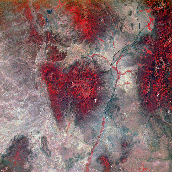
The straight line on the left is the Nacimiento faults, a boundary between the Precambrian rocks of the San Pedro Parks and the sedimentary rocks of the San Juan basin. This false-color Landsat image has dry areas as grey-brown and wooded areas as red. The flat plateaus around the Valles caldera (center) are canyons within the Bandelier Tuff. |