|
COMETS EARTH JUPITER KUIPER BELT MARS MERCURY METEORITES NEPTUNE OORT CLOUD PLUTO SATURN SOLAR SYSTEM SPACE SUN URANUS VENUS ORDER PRINTS
PHOTO CATEGORIES SCIENCEVIEWS AMERICAN INDIAN AMPHIBIANS BIRDS BUGS FINE ART FOSSILS THE ISLANDS HISTORICAL PHOTOS MAMMALS OTHER PARKS PLANTS RELIGIOUS REPTILES SCIENCEVIEWS PRINTS
|
Related Document
Download Options
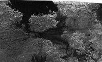
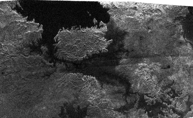
This radar image, obtained by Cassini's radar instrument during a near-polar flyby on Feb. 22, 2007, shows a big island smack in the middle of one of the larger lakes imaged on Saturn's moon Titan. This image offers further evidence that the largest lakes are at the highest latitudes. The island is about 90 kilometers (62 miles) by 150 kilometers (93 miles) across, about the size of Kodiak Island in Alaska or the Big Island of Hawaii. The island may actually be a peninsula connected by a bridge to a larger stretch of land. As you go farther down the image, several very small lakes begin to appear, which may be controlled by local topography. This image was taken in synthetic aperture mode at 700 meter (2,300 feet) resolution. North is toward the left. The image is centered at about 79 north degrees north and 310 degrees west. |