|
COMETS EARTH JUPITER KUIPER BELT MARS MERCURY METEORITES NEPTUNE OORT CLOUD PLUTO SATURN SOLAR SYSTEM SPACE SUN URANUS VENUS ORDER PRINTS
PHOTO CATEGORIES SCIENCEVIEWS AMERICAN INDIAN AMPHIBIANS BIRDS BUGS FINE ART FOSSILS THE ISLANDS HISTORICAL PHOTOS MAMMALS OTHER PARKS PLANTS RELIGIOUS REPTILES SCIENCEVIEWS PRINTS
|
Related Document
Download Options
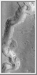
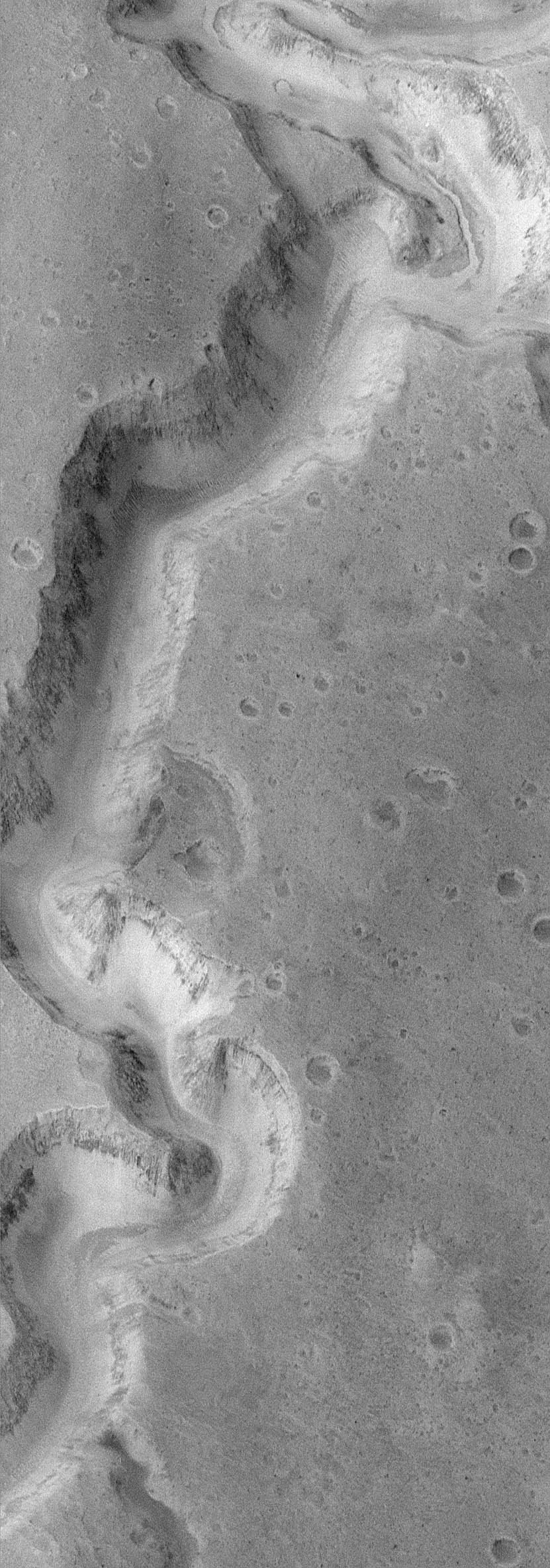
It has been known since the discoveries of Mariner 9 in 1972 that water once flowed on Mars and carved a variety of canyons, valleys, and channels. Some of this water appears to have gushed across the landscape in sudden, massive floods. Other valleys appear to be the result of water that flowed underground and sometimes caused the ground to collapse and sediment to be transported away. But one puzzle that has remained for more than 20 years--did any of these valleys experience sustained flow of liquid water at the martian surface over long periods of time? MOC image 8704 (above) shows a portion of the meandering canyons of the Nanedi Valles system--one of several valleys that cut through the smooth and cratered plains of the Xanthe Terra region of Mars. The valley is about 2.5 km (1.6 mi) wide. The floor of the valley in the upper right corner of the MOC image exhibits a small, 200 m (660 ft) wide channel that is covered by dunes and debris elsewhere on the valley floor. The presence of this channel suggests that the valley might have been carved by water that flowed through this system for an extended period of time. In other words, instead of a massive, catastrophic flood, this valley might have been incised in a manner similar to rivers on Earth. The valley itself would have widened by a variety of processes in addition to the water flowing along the bottom of the channel--slumps and landslides, wind, and perhaps groundwater flow could have all contributed to these processes. MOC image 8704 was taken on January 8, 1998. The scene covers 9.8 km by 27.9 km (6.1 miles by 17.3 miles). The image is centered on 5.1°N latitude and 48.26°W longitude. North is approximately up, illumination is from the left. The image dimensions have been corrected from an original aspect ratio of 1.5. |