|
|
[63] ALTHOUGH DEFORMATIONAL FEATURES are common on the Martian surface, the type of deformation differs from that on Earth. Deformation of Earth's surface is controlled largely by plate motion. Where plates converge, intense folding, overthrusting, and transcurrent faulting result, and mountain chains may form. Where plates diverge, as at midoceanic ridges, tensional features develop, but they are commonly masked by volcanic deposits. Apparently no plate motion occurred on Mars, and the deformational features associated with plate motion on Earth are absent. The dominant type of deformation on Mars is normal faulting; compressional and transcurrent features, although present, are rare.
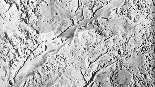
Most faults are associated with the Tharsis uplift, a 6000-km diameter, 7-km high bulge in the Martian crust roughly centered on Tharsis. Around the periphery of the bulge, and aligned approximately radial to it, are numerous fractures, some of which extend as far as 4000 hen from the center. So extensive are the radial fractures that they are the dominant structural feature of the entire hemisphere. Fracturing seems to vary greatly in intensity and age. In some places, such as in the Ceraunius and Tantalus Fossae (north of Tharsis) and the Claritas Fossae (south of Tharsis), fracturing is extremely intense; other areas are completely free of fractures. The number of craters superposed on the fractures is a measure of their relative ages and indicates a wide range of ages. Thus, fracturing associated with the Tharsis bulge evidently has continued for much of the planet's history.
Although fractures around 'Tharsis include the most prominent tectonic features on the planet, several fracture systems seem unrelated to Tharsis. Some fractures occur around old impact basins and are generally concentric to them. Especially prominent are the Nilae Fossae around the Isidis basin, but less distinct concentric graben and scarps are visible around the Argys and Hellas basins. Dominantly northeast-southwest and northwest-southeast lineaments are detectable throughout much of the old cratered terrain as escarpments or linear sections of crater walls. Where the old cratered terrain is eroded, as in the fretted terrain, the erosion occurred preferentially along these directions.
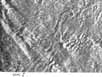
Mare ridges are other possible examples of deformational features. Such ridges are common on the sparsely cratered plains of Lunae Planum, Syria Planum, Hesperia Planum, and around the site of Viking Lander 1 in Chryse Planitia. In fact, Viking Lander 1 is believed to have landed on a ridge crest. Similar ridges have been studied intensively on the Moon and are considered to be the surface expression of reverse or thrust faults, which formed either contemporaneously with deposition of the lunar mare rocks, or some time [64] after, as a result of accommodation of the Moon's surface to the lava deposition. The ridges on Mars have a striking resemblance to those on the Moon and are probably of similar origin. Terrestrial analogs have not been found, however, and their origin remains uncertain.
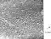
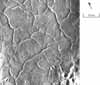
Most of the cratered plains in the northern latitudes of Mars exhibit a polygonal pattern of fractures for which there is no terrestrial analog. Individual polygons average approximately 10 km across and extend uniformly in all directions. Ice wedging and contraction by cooling have been suggested as possibilities, but no completely satisfactory explanation has yet been found.


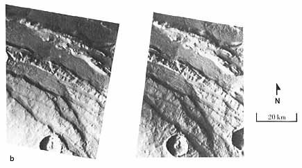 (b)
(b)