|
COMETS EARTH JUPITER KUIPER BELT MARS MERCURY METEORITES NEPTUNE OORT CLOUD PLUTO SATURN SOLAR SYSTEM SPACE SUN URANUS VENUS ORDER PRINTS
PHOTO CATEGORIES SCIENCEVIEWS AMERICAN INDIAN AMPHIBIANS BIRDS BUGS FINE ART FOSSILS THE ISLANDS HISTORICAL PHOTOS MAMMALS OTHER PARKS PLANTS RELIGIOUS REPTILES SCIENCEVIEWS PRINTS
|
Related Document
Download Options
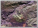
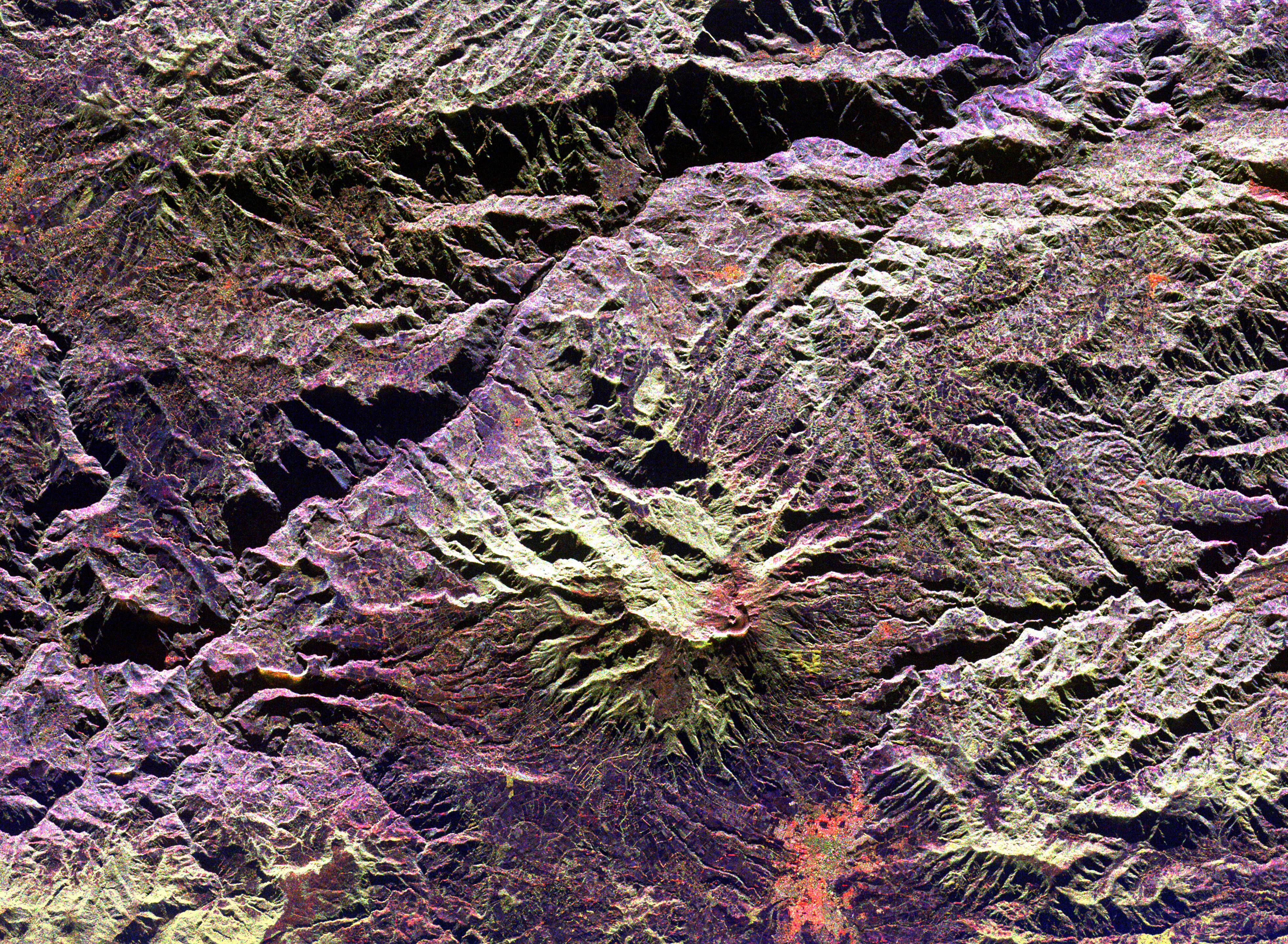
This radar image of the area surrounding the Galeras volcano in southern Colombia shows the ability of a multi-frequency radar to map volcanic structures that can be dangerous to study on the ground. Galeras has erupted more than 20 times since the area was first visited by European explorers in the 1500s. Volcanic activity levels have been high in the last five years, including an eruption in January 1993 that killed nine people on a scientific expedition to the volcano summit. Galeras is the light green area near the center of the image. The active cone, with a small summit pit, is the red feature nestled against the lower right edge of the caldera (crater) wall. The city of Pasto, with a population of 300,000, is shown in orange near the bottom of the image, just 8 kilometers (5 miles) from the volcano. The image was acquired by the Spaceborne Imaging Radar-C/X-Band Synthetic Aperture Radar (SIR-C/ X-SAR) aboard the space shuttle Endeavour on its 96th orbit on April 15, 1994. North is toward the upper right. The area shown is 49.1 by 36.0 kilometers (30.5 by 22.3 miles), centered at 1.2 degrees north latitude and 77.4 degrees west longitude. The radar illumination is from the top of the image. The false colors in this image were created using the following radar channels: red represents the L-band (horizontally transmitted and received); green represents the L-band (horizontally transmitted, vertically received); blue represents the C-band (horizontally transmitted, vertically received). Galeras is one of 15 volcanoes worldwide that are being monitored by the scientific community as an "International Decade Volcano" because of the hazard that it represents to the local population. Spaceborne Imaging Radar-C and X-band Synthetic Aperture Radar (SIR-C/X-SAR) is part of NASA's Mission to Planet Earth. The radars illuminate Earth with microwaves, allowing detailed observations at any time, regardless of weather or sunlight conditions. SIR-C/X-SAR uses three microwave wavelengths: L-band (24 cm), C-band (6 cm) and X-band (3 cm). The multi-frequency data will be used by the international scientific community to better understand the global environment and how it is changing. The SIR-C/X-SAR data, complemented by aircraft and ground studies, will give scientists clearer insights into those environmental changes which are caused by nature and those changes which are induced by human activity. SIR-C was developed by NASA's Jet Propulsion Laboratory. X-SAR was developed by the Dornier and Alenia Spazio companies for the German space agency, Deutsche Agentur fuer Raumfahrtangelegenheiten (DARA), and the Italian space agency, Agenzia Spaziale Italiana (ASI), with the Deutsche Forschungsanstalt fuer Luft und Raumfahrt e.v.(DLR), the major partner in science, operations and data processing of X-SAR. |