|
COMETS EARTH JUPITER KUIPER BELT MARS MERCURY METEORITES NEPTUNE OORT CLOUD PLUTO SATURN SOLAR SYSTEM SPACE SUN URANUS VENUS ORDER PRINTS
PHOTO CATEGORIES SCIENCEVIEWS AMERICAN INDIAN AMPHIBIANS BIRDS BUGS FINE ART FOSSILS THE ISLANDS HISTORICAL PHOTOS MAMMALS OTHER PARKS PLANTS RELIGIOUS REPTILES SCIENCEVIEWS PRINTS
|
Related Document
Download Options
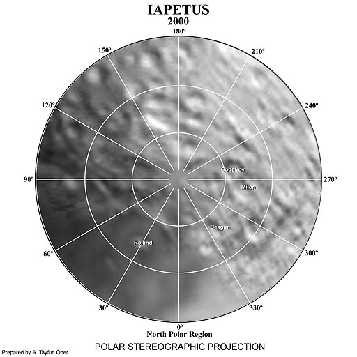
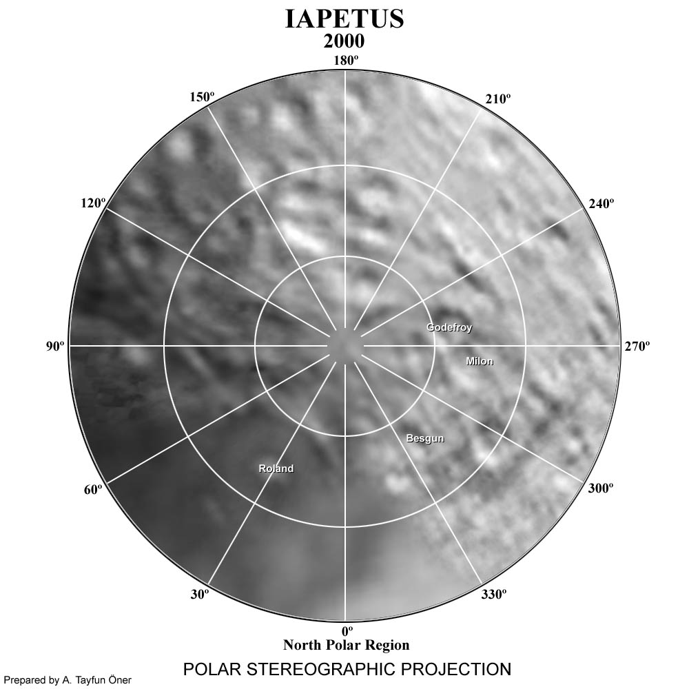
This image in a north polar stereographic projection map of Iapetus It covers latitudes 65 to 90 degrees and was made from images taken by the Voyager 2 spacecraft. This image is Copyrighted © 2000 by A. Tayfun Oner. Any commercial/for-profit use of this image needs to be addressed to Calvin J. Hamilton. |