|
COMETS EARTH JUPITER KUIPER BELT MARS MERCURY METEORITES NEPTUNE OORT CLOUD PLUTO SATURN SOLAR SYSTEM SPACE SUN URANUS VENUS ORDER PRINTS
PHOTO CATEGORIES SCIENCEVIEWS AMERICAN INDIAN AMPHIBIANS BIRDS BUGS FINE ART FOSSILS THE ISLANDS HISTORICAL PHOTOS MAMMALS OTHER PARKS PLANTS RELIGIOUS REPTILES SCIENCEVIEWS PRINTS
|
Related Document
Download Options
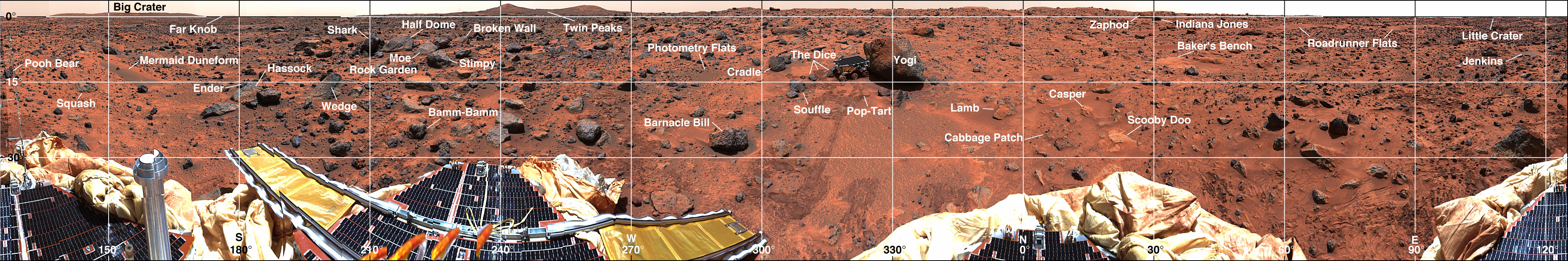
Mars-local-level (LL frame) coordinate map of rocks counted at the Mars Pathfinder landing site. Positions, apparent diameters (D), and heights (H) were measured to the nearest centimeter in the Marsmap virtual reality environment constructed from the "Monster Pan". Image Note: Science Magazine, Volume 278, Number 5344, 5 December 1997, 'Mars Pathfinder Foldout' (Plate 6). |