|
COMETS EARTH JUPITER KUIPER BELT MARS MERCURY METEORITES NEPTUNE OORT CLOUD PLUTO SATURN SOLAR SYSTEM SPACE SUN URANUS VENUS ORDER PRINTS
PHOTO CATEGORIES SCIENCEVIEWS AMERICAN INDIAN AMPHIBIANS BIRDS BUGS FINE ART FOSSILS THE ISLANDS HISTORICAL PHOTOS MAMMALS OTHER PARKS PLANTS RELIGIOUS REPTILES SCIENCEVIEWS PRINTS
|
Related Document
Download Options
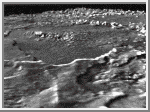
This is a computer-gnerated perspective rendering of one of the caldera-like depressions on Triton, as it would appear if viewed from the northeast. The image was obtained by geometrically reprojecting part of a Voyager high-resolution frame taken Aug. 24, 1989, when the spacecraft was about 181,800 km (112,900 miles) from Triton. Information about surface topography needed to generate the oblique view was obtained from the same image by the technique called photoclinometry (also called "shape from shading"). In the method, a computer is used to construct a map of the elevation at every point on the image. The computer repeatedly adjusts the map until its appearance (calculated using the known light-scattering properties of Triton) matches the actual image as closely as possible, with bright areas sloping toward the Sun and darker areas sloping away. The topography was vertically exaggerated 20 times in producing this perspective view. Actual relief in the region has a maximum range of about 1 km (3,000 feet) in the 13 km (8-mile) diameter impact crater visible in the center of the image. The caldera floor, approximately 200 km (120 miles) in diameter, is extremely flat and probably was formed by the volcanic eruption of ice lavas of very low viscosity. The bench visible in the foreground may be a remnant of earlier flooding to a level about 200 meters (600 feet) higher than the present calders floor. |
