|
COMETS EARTH JUPITER KUIPER BELT MARS MERCURY METEORITES NEPTUNE OORT CLOUD PLUTO SATURN SOLAR SYSTEM SPACE SUN URANUS VENUS ORDER PRINTS
PHOTO CATEGORIES SCIENCEVIEWS AMERICAN INDIAN AMPHIBIANS BIRDS BUGS FINE ART FOSSILS THE ISLANDS HISTORICAL PHOTOS MAMMALS OTHER PARKS PLANTS RELIGIOUS REPTILES SCIENCEVIEWS PRINTS
|
Related Document
Download Options
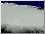
This movie depicts the airborne laser altimeter collecting data. In 1993 and 1994, NASA researchers surveyed the Greenland ice sheet using an airborne laser altimeter. Ten flight lines flown in 1993 in southern Greenland were resurveyed in 1998. Scientists used computers to create detailed maps of changes in the ice.
The Many Faces of Laser Altimetry A study of Greenland indicates a rapid thinning of glaciers along the east coast of the southern half of the island and suggests that the lower elevation portion of the ice sheet may be particularly sensitive to changes in climate. The results of this study are significant because they provide the first evidence of widespread thinning of low-elevation parts of one of the great polar ice sheets. Areas of ice thinning are shown in blue, areas where ice is thickening are shown in orange. |