|
COMETS EARTH JUPITER KUIPER BELT MARS MERCURY METEORITES NEPTUNE OORT CLOUD PLUTO SATURN SOLAR SYSTEM SPACE SUN URANUS VENUS ORDER PRINTS
PHOTO CATEGORIES SCIENCEVIEWS AMERICAN INDIAN AMPHIBIANS BIRDS BUGS FINE ART FOSSILS THE ISLANDS HISTORICAL PHOTOS MAMMALS OTHER PARKS PLANTS RELIGIOUS REPTILES SCIENCEVIEWS PRINTS
|
Related Document
Download Options
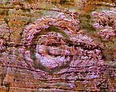
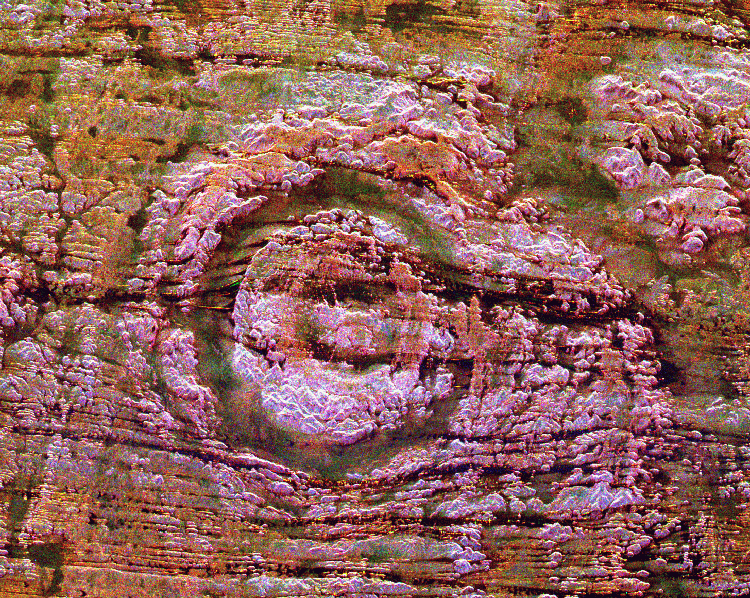
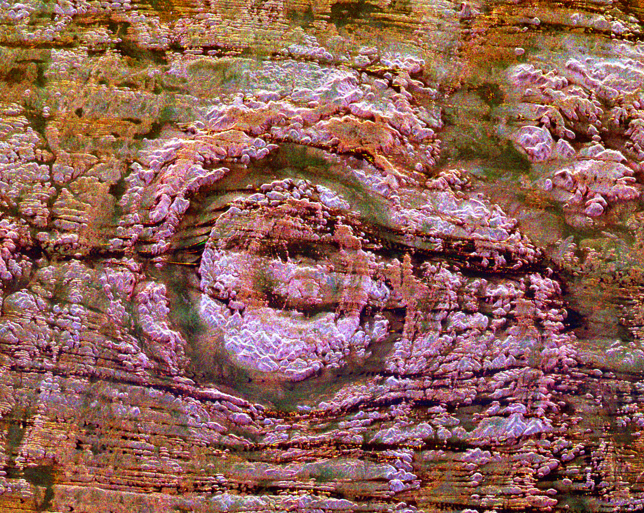
The impact of an asteroid or comet several hundred million years ago left scars in the landscape that are still visible in this spaceborne radar image of an area in the Sahara Desert of northern Chad. The concentric ring structure is the Aorounga impact crater, with a diameter of about 17 kilometers (10.5 miles). The original crater was buried by sediments, which were then partially eroded to reveal the current ring-like appearance. The dark streaks are deposits of windblown sand that migrate along valleys cut by thousands of years of wind erosion. The dark band in the upper right of the image is a portion of a proposed second crater. Scientists are using radar images to investigate the possibility that Aorounga is one of a string of impact craters formed by multiple impacts. Radar imaging is a valuable tool for the study of desert regions because the radar waves can penetrate thin layers of dry sand to reveal details of geologic structure that are invisible to other sensors. The image was acquired by the Spaceborne Imaging Radar-C/X-band Synthetic Aperture Radar (SIR-C/X-SAR) on April 18 and 19, 1994, onboard the space shuttle Endeavour. The area shown is 22 kilometers by 28 kilometers (14 miles by 17 miles) and is centered at 19.1 degrees north latitude, 19.3 degrees east longitude. North is toward the upper right. The colors are assigned to different radar frequencies and polarizations as follows: red is L-band, horizontally transmitted and received; green is C-band, horizontally transmitted and received; and blue is C-band, horizontally transmitted, vertically received. SIR-C/X-SAR, a joint mission of the German, Italian and United States space agencies, is part of NASA's Mission to Planet Earth program. This image is in the public domain and is copyright free. |